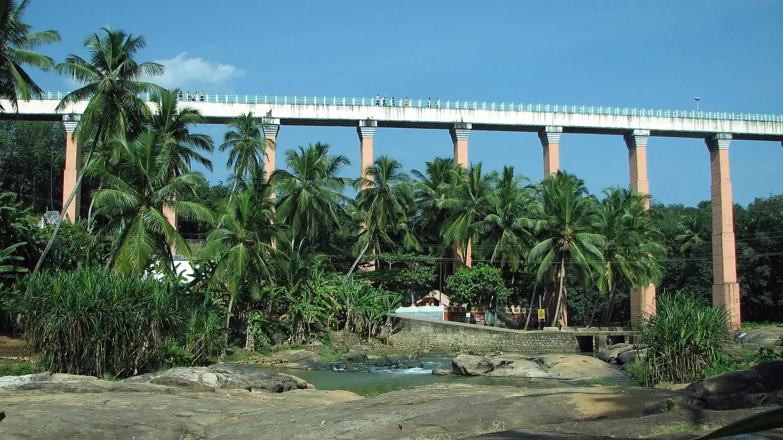
Mathur Aqueduct: walking a kilometre of canal 115 feet above the river
Mathur Aqueduct is a working irrigation channel that you are allowed to walk along, and that is the whole appeal. Built in 1966 to carry the Pattanamkal canal across the Parazhiyar river valley near Thiruvattar, it stands about 115 feet high on 28 concrete pillars and runs close to a kilometre from one hillside to the other. Local people call it Mathur Thottipalam, the trough bridge, and it is regularly described as the tallest and longest of its kind in Asia. The trough itself is roughly seven feet wide and seven feet deep, and a railed footpath runs along both edges, so you walk with running canal water beside your knees and rubber trees a long way below your feet.
The catch is that the water is seasonal. From August to January the canal runs full and the river below is a proper river. In April and May the trough is often dry, the Parazhiyar is a string of pools, and the walk is still worth doing for the height, but the photographs are duller. Entry is ₹10, the site opens at 9 am and shuts at 6 pm, and there is a hanging footbridge, a small park and a bathing ghat down at river level. It is 60 km from Kanyakumari, so it sits at the far end of a western-district day rather than being a quick stop.
The walk across the trough and which side to take
You climb to the aqueduct from the ticket gate on the eastern bank up a flight of about 200 concrete steps, which takes most people six or seven minutes with a pause. At the top the path splits either side of the water channel. Take the southern footpath on the way out; it faces the open valley and the view down the Parazhiyar towards the plains, while the northern path looks back into the hills. Cross on one side and return on the other and you have seen both.
The footpath is about two feet wide with a waist-high railing on the outer edge and the canal on the inner edge. It is safe for adults and for children who will hold a hand, but there is no shade for the whole kilometre, which is why the midday walk in April is a slog and the same walk at 4:30 pm is pleasant. In strong wind or heavy rain the staff shut the top path completely, and that happens more often than the timing board suggests between October and December. Allow twenty-five minutes for the full crossing and back, longer if you stop at the centre pillar, which is where the height is most obvious. People with a fear of heights usually manage the first hundred metres, decide that is enough, and are perfectly happy. The trough is the kind of place where the view is the same after 200 m as after 900 m, so nobody should feel obliged to finish.
Down at river level: the hanging bridge, the park and the bathing ghat
Most visitors walk the top, take a photograph, and leave, and they miss the better half. A path from the ticket gate drops to the river, where a suspension footbridge crosses the Parazhiyar just downstream of the pillars. Standing on it and looking up gives you the only angle from which the aqueduct looks as tall as it is. The hanging bridge sways, which children love and grandparents do not, and it is free.
Beside it is a small park with lawns and a few play frames, and a stepped bathing ghat where local families get into the river when it is running. The water here is shallow and slow in the dry months and is a genuine swimming spot from September to December, though there is nobody on duty and the current picks up after rain. This is also where people eat. Bring food from Thiruvattar or Kulasekharam because the stalls at the gate sell only tea, biscuits and cut fruit, and the one proper hotel nearby closes between 3 and 6 pm. Monkeys are fewer than at Thirparappu but present; keep bags zipped. Toilets are near the ticket counter and are basic. Boating on the river operates only when the water level allows, roughly October to January, at ₹50 a head for fifteen minutes, and it is rowing boats rather than anything motorised, which suits the place.
When to come: light, water and crowds
Three things decide whether Mathur is a highlight or a hot concrete walk: the time of day, the month, and the day of the week. Time of day first. The valley runs roughly east to west, so from 3:30 pm the western hills throw shade across the pillars and the top path, and the light on the trough turns warm. Morning light is flat and by 11 am the concrete is uncomfortably hot underfoot. We schedule Mathur as the last stop of a western day for exactly this reason, arriving around 3:30 and leaving at 5:30 for the drive back.
Month next. August to January gives you canal water, river water and green rubber below. February is still fine. March to May the canal is usually drawn down, the river shrinks and the whole scene is brown; it is still a tall bridge, but honestly the drive from Kanyakumari is a long one for a dry trough. June and July are green but wet, with a real chance of the top path being shut. Crowds are lightest on weekday afternoons in any month. Sundays and holidays bring bus groups from Nagercoil and Thiruvananthapuram, and on a holiday afternoon the two-foot footpath becomes a slow single file with people trying to pass in both directions. If your only free day is a Sunday, be at the gate at 9 am when it opens.
Getting there and putting it into a day
From Kanyakumari the route is Nagercoil, then the Thiruvattar road through Thuckalay or via Kulasekharam, about 60 km and an hour and a half. The last three kilometres from Thiruvattar are narrow, winding and busy with two-wheelers, and the final approach drops steeply to the car park, which holds about forty cars and costs ₹30. On Sundays the overflow parks along the road above and the walk down adds five minutes. There is a bus from Thiruvattar to Mathur roughly every half hour, and Thiruvattar itself is served from Nagercoil every fifteen minutes.
Very few people come to Mathur alone. The natural day is Padmanabhapuram Palace at 9 am, Thirparappu Falls before lunch, then Mathur from 3:30, which is around 140 km of driving and comes to ₹2,800 in a sedan or ₹4,200 in an Innova Crysta with fuel, tolls, parking and the driver included. If the falls are dry, swap them for Pechiparai Dam, 15 km from Mathur. Travellers heading on to Kerala can take in Mathur and the palace and cross the border at Kaliyakkavilai without coming back to Kanyakumari at all. Ask the driver to stop at the Thiruvattar Adikesava Perumal temple on the way if you have twenty minutes spare; it is older than Padmanabhapuram and almost nobody visits.
Who it suits, and the honest limits
Mathur is one of the few places in the district where children between six and twelve are genuinely happy: a high bridge to walk, a swaying rope bridge below, a river to paddle in and a lawn to run on. Photographers get their picture from the hanging bridge and from the centre of the trough. Engineers and anyone who enjoys a bit of Kamaraj-era public works will like the fact that it is still doing its job sixty years on, feeding the paddy of Vilavancode and Kalkulam.
It suits some people less well. The 200 steps to the top have no lift and no gentle alternative, so an elderly traveller who cannot manage stairs will see the aqueduct only from below, which is still a good view but not the experience. Anyone uneasy with heights should know that the railing is on one side only and the canal is on the other. There is no restaurant, so a family arriving hungry at 1 pm has a poor time. And the site is plain: concrete, water, trees, no signage worth reading. If you are hoping for something ornamental, the palace is that; Mathur is a piece of infrastructure you happen to be allowed to stand on. Give it seventy-five minutes at the right time of day and it earns its place. Our Kerala to Kanyakumari route takes it in on the border crossing day.
Six things our drivers tell every guest
- Arrive after 3:30 pm. The valley falls into shade and the top path, which has no cover at all, becomes comfortable.
- Come between August and January for a full canal and a flowing river. In April and May the trough is often dry.
- Walk out on the southern footpath for the valley view and back on the northern one for the hills.
- Go down to the hanging bridge. Looking up at the pillars is the only angle that shows the real height.
- Eat before you arrive. The stalls at the gate sell only tea and snacks and the nearest hotel shuts mid-afternoon.
- There are about 200 steps to the top and no lift. Anyone who cannot manage stairs should plan to stay at river level.
How to get here
Mathur Aqueduct is 60 km from Kanyakumari town, 1 hr 30 min. It is included in our 2 days 1 night package and our kerala + kanyakumari package, or we can add it to any local sightseeing day by the hour.
Questions about Mathur Aqueduct
Nearby places to add to the same day
 55 km
A broad 50 ft curtain on the Kodayar river, 55 km west. Strong June to January, often dry in summer.
Thirparappu Falls is 55 km from Kanyakumari and flows strongly June to January. Entry ₹10, open 8 am to 6 pm. We say which months it runs dry.
 35 km
Asia’s largest wooden palace, 35 km up the Thuckalay road. Closed Mondays.
Padmanabhapuram Palace is 35 km from Kanyakumari, open 9 am to 4.30 pm, closed Mondays. Entry ₹35, camera ₹50. The Mantrasala and granite bed explained.
 60 km
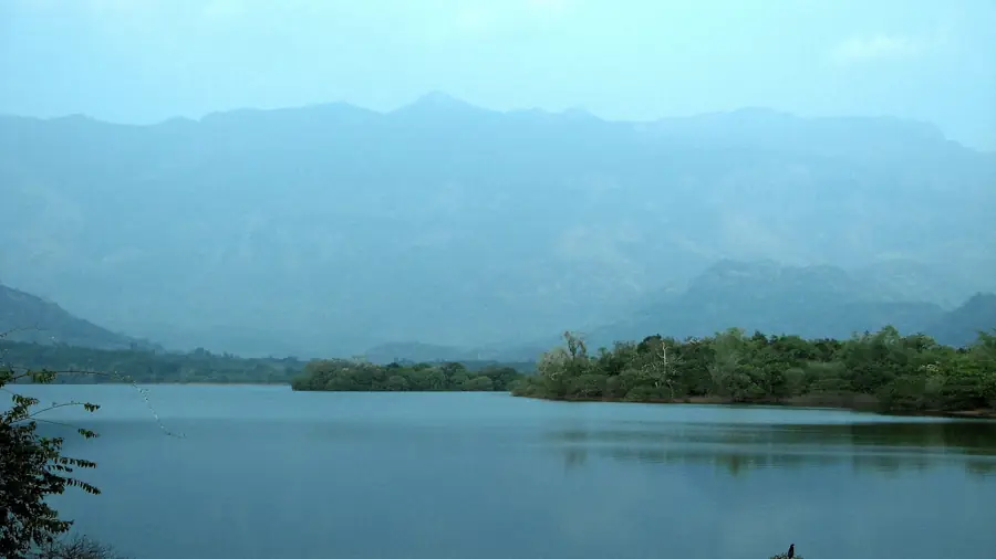
Pechiparai Dam
Pechiparai Dam is 60 km from Kanyakumari, built in 1906 on the Kodayar river. Garden ₹10, boating ₹100, open 9 am to 5.30 pm. When the reservoir is full.
Want Mathur Aqueduct at the right hour?
We know when the queue is short and when the light is good. One message and it is in your plan.